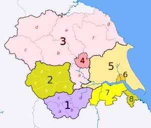
Yorkshire-and-the-Humber-map
“Yorkshire and the Humber counties 2009 map” by Yorkshire_and_the_Humber_districts_2011_map.svg: Nilfanion, created using Ordnance Survey dataEnglish_ceremonial_counties_2010.svg: Nilfanionderivative work: Dr Greg – This file was derived from:Yorkshire_and_the_Humber_districts_2011_map.svgEnglish_ceremonial_counties_2010.svg. Licensed under Creative Commons Attribution-Share Alike 3.0 via Wikimedia Commons – http://commons.wikimedia.org/wiki/File:Yorkshire_and_the_Humber_counties_2009_map.svg#mediaviewer/File:Yorkshire_and_the_Humber_counties_2009_map.svg

Discussions